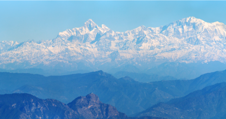

Himalayas is the youngest and highest mountain range of the world. It separates the Indian subcontinent to the Tibetan plateau.
Himalayas stretched across the six countries India, Pakistan, Afghanistan, Nepal, Bhutan and China and also the source of the world’s major river basin. 1. Idus basin 2. Gange-Brahmaputra basin and 3. Yangtze River basin.
Meaning of Himalayas
Himalayas = Him + Alayas
Snow + abode
Himalayas = abode of the snow.
According to the Indian scriptures, Himavat was the ruler of the Himalayas.
Birth of the Himalayas

Himalaya is the youngest mountain range on the planet. Its formation is the result of a continental collision between the Indo-Australian Plate and the Eurasian Plate.
225 million years ago India was a large island situated off the Australian coast and separated from Asia by the Tethys Ocean. The supercontinent Pangea began to break up 200 million years ago and India started a northward drift towards Asia.
By about 50 million years ago fast-moving Indo-Australian plate had completely closed the Tethys Ocean since these sediments were light, they crumpled into mountain ranges rather than sinking to the floor. The Indo-Australian plate continues to be driven horizontally below the Tibetan plateau, which forces the plateau to move upwards.
The Himalayas are still rising by more than 1 cm per year because the India continues to move northwards into Asia which makes this region seismically active and leading to earthquakes from time to time.
Geography
The Himalayas are about 2400 km (1500 mi) long. The width of the Himalayas from south to north varies between 125 and 250 miles (200 and 400 km) furthermore, the total area covered by the Himalayas is 230,000 square miles (595,000 square km).
The Himalaya proper stretches from the Indus River (beyond Nanga Parbat peak) in Pakistan, through India, Nepal, and Bhutan, and ends at the Brahmaputra River (after Namcha Barwa peak in southeast Tibet and northeast India) in eastern India.
Himalaya consists of three parallel mountain range
- Lower Himalaya (Shivalik Hills or Outer Himalayas) – It is the southmost range with the elevation of around 1200 m.
- Middle Himalaya (Himachal or Lesser Himalayas) – Located to the north of the Shivalik hills having an elevation between 2,000–5,000 m.
- Greater Himalayas (Himadri) – Northmost range. It has an elevation of more than 6,000 m and contains the world’s some of the highest peaks.
Still More based on the location…
- The Trans-Himalayas – Tibetan Himalayas.
The Himalayan ranges immediately north of the Great Himalayan range, also called the Tibetan Himalaya because most of it lies in Tibet. The Zaskar, the Ladakh, the Kailas and the Karakoram are the main ranges.
- The Eastern Hills – Purvanchal: A chain of hills in North-East India.
Eastern Hills or The Purvanchals are the southward extensions of the Himalayas running along the north-eastern edge of India. At the Dihang gorge river, the Himalayas take a sudden southward bend and form a series of comparatively low hills which are collectively called the Purvanchal. They run along the India-Myanmar Border extending from Arunachal Pradesh in the north to Mizoram in the south.
Peaks and Passes of the Himalaya
Himalaya is the home of several highest peaks. The world’s 10 highest peaks are in the Himalayas and its 11 peaks are above 8000 meters. More than 50 peaks are above 7000 meters.
The name of the 5 highest peaks is:
- Mount Everest – 8,848.86 Meters – Situated in Nepal
- K2 – 8,611 Meters – Situated in Pakistan
- Kanchenjunga – 8,586 Meters – Situated in India
- Lhotse – 8,516 Meters – Situated in Nepal
- Makalu – 8,485 Meters – Situated in Nepal
All about Passes
Passes are the land between areas of the Mountains. There are so many passes in the Himalayas which connect different regions, some important passes are:
- Banihal Pass – across the Pir Panjal Range at 2,832 m (9,291 ft)
- Jelep la pass – high mountain pass between India and Tibet in East Sikkim.
- Karakoram Pass – between India and China in the Karakoram Range.
- Kora La – considered the lowest drivable path between Tibetan Plateau and the Indian subcontinent
- Mana Pass – one of the highest vehicle-accessible passes in the world at the India-China border.
- Nathu la – It connects the Indian state of Sikkim with China’s Tibet Autonomous Region
- Rohtang Pass – connects the Kullu Valley with the Lahul and Spiti Valleys of Himachal Pradesh, India.
Rivers originate from Himalaya
The mighty Himalayas act as the water tower of the South and Southeast Asian region.
The Indus, Ganga, and the Brahmaputra are the three major Himalayan rivers in India. These all rivers fed on the glacier water and rain. Moreover, they flow westward and collectively form the Himalayan River system with their tributaries.
There are many other rivers flowing through the Himalayas, some of them are:
- Raidāk River is the trans boundry Himalayan River. It flows through Bhutan, India and Bangladesh and one of the tributary rivers of the Brahmaputra.
- Ghaghra or Karanali is also trans-border Himalayans River originates from the Tibetan plateau near Manasarovar. It is the major tributary of the Gange River.
- Gandaki River is another Himalayan River, flowing through India and Nepal. It is the left bank tributary of the Gange river.
- Kosi or the Saptakoshi is trans boundry river, passing through Tibet, Nepal and India. It branches into distributaries before joining the Ganges. It drains the northern slopes of the Himalayas in Tibet and the southern slopes in Nepal.
- Mekong is the word’s 12th and Asia’s 6th largest river. It is transboundary river, flowing through China, Myanmar, Laos, Thailand, Cambodia, and Vietnam.
- Yangtze is the Asia’s longest and word’s third largest river originate from the Tibetan plateau. It flows entirely in one country China. One third population China is depend on this river.
- Sutlej is one of the tributaries of the Indus River flowing through India and Pakistan.
- Salween is the south east Asian river flowing through southwest China and eastern Myanmar (Burma).
- Yellow River (Huang Ho River) is the second largest river of the China and the 6th largest of the world. Its basin was the birthplace of ancient Chinese civilization, and it was the most prosperous region in early Chinese history
Lakes in Himalayas
The Himalayas is the home of many lakes overall 4,699 high-altitude lakes are mapped.
Some of the famous lakes are:
- Manasarovar Lake
The most famous is the Manasarovar lake. It occupies 420 square km of area and is at 4520-meter height from the Sealevel. It has very religious importance in Indian and Tibet people.
- Pangong lake
It is situated at an elevation of 4,225 m (13,862 ft). It is 134 km (83 mi) long and divided into five sub lakes, called Pangong Tso, Tso Nyak, Rum Tso (twin lakes) and Nyak Tso. Approximately 50% of the length of the overall lake lies within Tibet China, 40% in Ladakh India, and the rest is disputed and is a de-facto buffer zone between India and China. The lake is 5 km (3.1 mi) wide at its broadest point
- Yamdrok lake
Yamdrok considers the biggest lake in the Himalayas. It’s a freshwater lake and one of the three largest sacred lakes in Tibet. It is over 72 km (45 mi) long. The lake is surrounded by many snow-capped mountains and fed by numerous small streams.
How Himalayas shaped Indian history?
The Himalayas are like the ‘great sentinel of the north’ for India. They prevented the dry and cold wind comes from Tibet, thus India remains the considerably warm and moist place to live. They have a very important role in circulating the summer monsoon in India and Tibet plateau. Populations and farming on Gangetic plains depend on this monsoon season.
About North-East Himalayas
Himalaya saved India from northeast invasion. The passes here are very difficult to cross because of the snow all around the year. The same way any Indian king never dreamt about conquering land beyond the mountains. However, there was a limited movement through the passes during the few weeks when the snow melted. This was mostly for trade and cultural purposes.
Northeast was very much influenced by Indian culture. A clear example is Tibet where many Indian saints went to spread their religion and culture.
About North-West Himalayas
The north-western ranges of the Himalayas are known as the Suleiman or the Hindukush mountains. They are not very high and a large number of passes enabled foreigners to enter India. Among the most famous is the Khaybar pass. It is 3400 feet from sea level and connects Peshawar to Kabul. Most of the foreign invaders were came through this pass. In addition, the Tochi, Kurram, and Gomal pass connects India with Afghanistan. The Bolen pass is a very wide one and links India with Kandahar. It is through these passes Persians, Greeks, Scythians, Kushans, Hun, Turks, Tarats and the Mughal attacked India. These passes changed the fortune of India.
Plains made from Himalayan rivers
The Indo-Gangetic plain made from the rivers of the Himalayas played important role in the establishment of the many dynasties and empires. The richness of the soil and easily available water sources made it the best place to live. Great political, social, philosophical ideas were born here, the Vedas were compiled here and most of the Sanskrit literature was written here at last Jainism and Buddhism were also born here.
Significance in different religions
In Jainism, Buddhism, Hinduism, and Sikhism, the Himalayas hold a very divine place. Their many pilgrimage places are in the Himalayas.
Jainism
In Jainism Mount Ashtapad (situated near Mount Kailash) occupies a very important place. According to the legends, the first Jain Tirthankara Rushabh deva has attained nirvana here. In memory of that his son King Bharat established a temple with crystal and gemstones.
Hinduism
As per the Hindu myth, Himalaya is the king Himavat. He is the father of the Devi Parvati (wife of lord shiva) and the holy river Ganga. His wife was Menavati (daughter of the mountain Meru).
Many pilgrimage places of Hindus resided in the Himalayas particularly Mount Amaranath, Mount Kailash, Chhota char Dham, Hrishikesh, and Haridwar.
Mount Kailash is considered as the ‘heavenly abode of Lord Shiva’. This place is known for the full of divinity, pure beauty, and the lifeline of some majestic rivers of Asia.
Hindu pilgrimage Badrinath, Kedarnath, Gangotri, and Yamunotri are considered as the Chhota char Dham. According to popular belief, one can attain moksha by visiting these places.
Haridwar is situated at the foothills of the Shivalik range and on the bank of the Gange river, it has very religious importance in Hinduism and is also believed to be the starting point for the Chhota Char Dham yatra.
Buddhism
The Buddhists also lay a great deal of importance on the Himalayas. Paro Taktsang is the holy place where Buddhism started in Bhutan. Moreover, the Himalayas has a number of Vajrayana Buddhist sites with over 6,000 monasteries in Tibet, including the residence of the Dalai Lama
At last the sad side..
Himalaya has a high value in the life of the South Asian people. The mention of the Himalayas is found in many old beliefs, scriptures, and many religions. In ancient times the Himalayas attracted many saints and pilgrims. Where in modern times it is the most famous place among hikers, climbers, and visitors. The beauty of the Himalayas lies in the variety of structures. It has all the high snow peaks, big and icy lakes, freshwater rivers, Passes, and Glaciers.
But the sad part is climate change has affected the Himalayas in many ways. Its frozen glaciers are melting now, deforest activities have changed the weather across the Himalayas. We need to stop this and respect nature the way it is. The Himalayas is the most important in every way for the south Asian people. It is now our turn to protect this — a gem of nature.
Don’t miss the Surprising Facts about Himalaya
- The Himalayas cover approximately 75% of Nepal.
- The Himalaya are the youngest mountain range of the planet.
- The Sachine glacier is the largest glacier of the world outside the polar region.
- Himalaya is also known as the third pole of the planet as it has the highest snow after north and south pole.
- Himalaya is the only mountain range of the world which is passing through the 6 countries.
- The height of the Himalayas is increasing by 1cm every year.
- Himalaya is the source of the 10 largest rivers in Asia.
- The other names of the Mount Everest are: The Tibetan Chomolungma means “Goddess Mother of the World” or “Goddess of the Valley.” The Sanskrit name Sagarmatha means literally “Peak of Heaven.” It was also previously known as Peak XV.
- Mount Everest is not a volcano but a folded mountain formed at the point of contact between the Indian and Eurasian plates.
- There are about 15,000 glaciers in the Himalayas.